Monday, July 30, 2012

My Day with a Real Nomad


You may know that I have a soft spot in my heart for the Ice Age Trail.  I may not care about a lot of things in life (who needs housing or financial security when you have a tent and a packet of rice?), but the Ice Age Trail is something I care dearly about.  So when Nimblewill Nomad decided to hike the Trail this year, I jumped at the chance to help him.  There are 11 National Scenic Trails in America and Nimblewill has hiked 9 of them, leaving the Ice Age Trail and New England Trail as the final missing pieces of the National Scenic Trail Crown.  No one has ever hiked all 11 trails so Nimblewill taking up the IAT is a big deal.  Any publicity and awareness for the Trail is a good thing.

I emailed Nimblewill before his hike to put forth my services through the Devil’s Lake area because that’s where the Trail Crew is supposed to be stationed this year.  The Trail Crew would have to be up and running by mid-July right?  You would be sorely mistaken because spring and summer are not good months for trail work in Wisconsin.  The weather has been a little too perfect to let the Trail Crew work outside… 

Anyways, Nimblewill was bearing down on the Devil’s Lake area so I gave him a call still offering a hiking compatriot and whatever help I could provide.  He accepted.  We were going to meet around the Merrimac Ferry and figure things out from there.  I woke up “early” (morning comes quick after being tempted by a beer or two served by Jess at the Come Back the night before), threw my things together and headed towards Lodi.  It was only supposed to be 101 (“can’t be much more than 114.  Dock that guy a days pay for sleeping on the job”) so the temps weren’t going to be a problem. 

I parked at the ferry, loaded up my daypack and headed into the Gibraltar Segment.  I slipped across Hwy 113 and flashed back to my hike when Luke showed up at this point with a cold beer for me.  From reading Nimblewill’s journal, I concluded we have different priorities when it comes to beverages.  I was nearly to the top of the hill when this old, scraggly fellow came bounding down the trail.  This must be Nimblewill Nomad.  Experienced hikers have a certain look about them that distinguishes them from regular trail users.  We exchanged pleasantries and headed down to the ferry.


We just missed the ferry, but that was OK as I brought out a Sierra Mist for Nimblewill and a plate of homemade banana blueberry bread I had appropriated from my parents house the night before.  We planned out the day while waiting for the ferry to return.  We’d have breakfast at a café in Merrimac and then I’d drive my car up to the north shore of Devil’s Lake and ride my bike back to the Rozno’s Meadow parking lot and hike the rest of the day with Nimblewill.  Well, the café was closed so our plan was on shaky ground to start.  I headed off to enact my part of the plan while Nimblewill did the short road walk and started the Merrimac Segment. 

With my car parked, I hopped on my bike to get back to Rozno’s.  Holy cow was I struggling.  The first mile or so was all up hill and I’m apparently in pretty poor shape.  Getting off my bike to walk up the hill actually crossed my mind.  I survived this sad showing of fitness and was soon zipping down to the parking lot.  I stashed my bike in the woods and headed into the Merrimac Segment to meet up with Nimblewill.  As soon as I crossed DL heading towards the new 300-foot boardwalk constructed in April, I noticed a fence with a herd of goats grazing.  Hmm, they must be trying to contain the invasive species.  I walked up to the fence that crossed the Trail, wondering if it was electrified.  There was a group of people looking at the goats and said it was safe to cross.  Sure enough, I knew the guy who owned the goats.  It was Jesse from Driftless Land Stewardship whom I had a few beers with when I worked at Wyalusing.
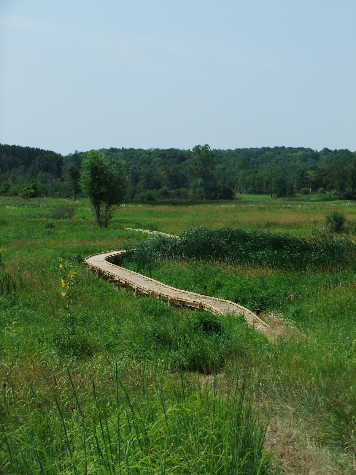


I met back up with Nimblewill and we retraced my steps through the goat enclosure and the April Merrimac MSC project.  I had one more trick up my sleeve as I had left a cooler with water, Gatorade, apples, peaches and other snacks for us at the end of the Merrimac Segment.  We hydrated and ate a little before heading into the shade-less meadow. 

Walking with Nimblewill, I played the part of tour guide as I rambled on about the history and geology of the area.  I’m not sure if this was useful (or welcomed), but I kept at it (apparently I can talk about the Devil’s Lake area for a long time).  We crossed the park road and began our ascent up to the top of the East Bluff.  When I wasn’t talking about the park, we talked about hiking and the shared experiences long-distance hikers have.  The places and people change, but the underlying story is the same; strangers going out of their way to help the wandering few continue their trek with food, water, a shower or even just a conversation.  His stories come from a lot larger reservoir than mine so they are more impressive and awe-inspiring, like the day he hiked 54 miles (I guess that happens when he’s hiked 25,000 miles and I’ve only stumbled for 1,100). 

As we approached the top of the bluff and the accompanying views, I began to worry that maybe it wasn’t as impressive as I thought.  I mean Nimblewill has hiked all over the country (literally) and seen sights that few have seen, what does little ol’ Wisconsin have that can compare?  My worries were unfounded as the trees fell back and the full view presented itself.  “This is really nice,” claimed Nimblewill.  I pointed out the Wisconsin River and where he had walked so far that day.  He was particularly interested in all the rock climbers populating the bluffs.  Taut ropes at our feet were tied to rocks and other anchors as the climbers were defying gravity. 


We continued our amble along the bluff with the glacial plug to our left at the base of the bluff.  I coaxed him into taking the short Devil’s Doorway detour and when the feature came into view there was a girl squirming her way into the Doorway, her rear end prominently in view.  “Now I know why you wanted to come this way,” chuckled Nimblewill.  People don’t say Devil’s Doorway has one of the best views in the park for nothing! 


We joined back up with the East Bluff Trail and continued to the west end of the bluff.  People stopped us to ask for directions because they didn’t have a map and apparently we looked like we knew where we were going.  I directed them where they needed to go and we began our descent down Balanced Rock Trail.  I was excited for Nimblewill to walk through the talus field only to find that he’s been on other trails that have the same thing.  Does anything surprise him anymore? 


Our next destination was the South Shore Concession Stand.  I was expecting we’d get something to eat but Nimblewill isn’t a big eater (my stomach looked longingly at the ice cream sandwiches).  He had 3 sodas from the soda fountain and we were back on the trail.  I tend to putz around and take my time, but Nimblewill is like the breeze, never pausing for long in any one place (I’m assuming this is one of the reasons he’s able to pack on way more miles than me). 

We huffed it up to the top of the West Bluff to get a different perspective of the area.  Quite spectacular!  I pointed out the glacial plugs holding in the lake and how an old river had once flowed through the bluffs.  The view would’ve been awesome on that river because before the glacier advanced this far, the gorge was 300 feet deeper so 800-900 feet deep.  Those damn glaciers and their debris!


If there were one aspect of hiking that I’m quicker than Nimblewill at, it would be going up and down stairs (Take that old-timer!).  It was a sight to see when we got down to the beach, as this bedraggled hiker walked amongst the throng of beachgoers.  It would be safe to say, we had different priorities than the people at the beach.  We stopped at the concession stand on the north shore for more soda and to plan out the evening.  Nimblewill offered to buy me dinner for hiking with him so he asked a worker where a good spot to eat was.  I told him we don’t need to find a place to eat because we were going to The Barn.  Fat chance we’d go somewhere else in the Devil’s Lake area! 

He was going to continue hiking while I retrieved my bike and meet him at Solum Lane.  After thinking about how to describe the route through the campground, I decided it would be easier for me to just hike with him.  He would’ve gotten lost otherwise (well taken the wrong turn at least).  Signage was sparse throughout the Devil’s Lake Segment and Nimblewill was glad to have someone guiding him.  I’d be willing to bet it’s the most poorly signed segment along the entire Ice Age Trail.  This needs to be rectified.  Devil’s Lake has nearly 2 million visitors a year, with a great number of those hiking on segments of the Trail and not even knowing it.  It’s a huge publicity possibility that is currently not utilized. 

I picked up my bike and cooler and headed over to Solum Lane and meet up with Nimblewill.  It’s a different feeling hiking by yourself after hiking with someone all day.  Your thoughts stay inaudible and in your head.  Earlier In the day, Nimblewill told me that the Appalachian Trail would gnaw and bug me until I hiked it.  The AT is the Trail in the United States and your hiking career isn’t complete until you’ve reached Mt. Katahdin via Springer Mountain.  I had told Nimblewill about my East Coast road trip last winter and how I only saw Katahdin and would like to go back someday to explore more. 
He asked, “Do you know how to get to Katahdin?” 
“No,” I replied. 
“Start at Springer.”
I suppose he’s right.  While walking to meet him, thoughts of the AT danced around my head.  I have other trails I’d like to hike first though.  I’m doing the Border Route Trail up in the Boundary Waters with Brad this fall, maybe the Florida Trail this winter, maybe, and then the Superior Hiking Trail next spring.  I need to make money somewhere to fund my adventures so the AT is off in the future.  Nimblewill appeared and we headed out to my car. 

Me with Katahdin in the background.  Hopefully I'll be able to take this same picture at the end of a thru-hike. 
We got to The Barn and Nimblewill was amused that The Barn was actually a barn.  We like our barns in Wisconsin (especially ones that serve beer).  Amber greeted us when we walked in and took our spots at the bar.  Amber and The Barn are great supporters of the Ice Age Trail and the food is great to boot.  I got a beer while Nimblewill got his soda and we ordered our food (it’s rare for me not to have a beer after a day on the Trail).  Our conversation on hiking and trail magic continued through the meal as we passed stories back and forth, never silent for long.  It was a great time. 

I finished my beer and wondered if I should get another one so when Nimblewill stepped out to take a phone call, I quickly motioned Amber over to get me another beer.  Whew!  While he was out, I paid the tab.  I wasn’t going to let him get away with paying for our dinner (most readers will find this hard to believe).  He greatly appreciated the gesture and we headed out to find a campsite.  I brought my tent just in case I hadn’t overstayed my welcome and Nimblewill wanted the company.  We found a spot and set up camp.  I laughed when I saw his pack compared to mine.  I was only out for the night and he was hiking 1100 miles, but his pack was a third the size and weight of mine.  

I didn't get a picture of the packs, but I think this gives you the idea
My tent was also a lot larger than his noseeum mesh tent, specially made for him.  His trekking poles were used as tent poles, giving him more room than most single person ultra lightweight tents.  With camp set up, we resumed our conversations.  With a long day of hiking behind us, we soon retreated back to our tents.  I was caked in sweat as the heat persisted.  Eventually I passed out, only to be woken up an hour later by a crazy noise.  What the hell was that?  Here's a video with the sound.  I heard footsteps rustling around in the dry leaves and decided it was a deer, but that noise was crazy!  The deer must have been interested because it kept walking close to camp only to scamper away and return shortly to repeat it, all while making that weird noise.  Oh well.

Dawn arose and so did we.  As Nimblewill broke down his tent, I went through his maps writing in good places to stop (Strawberry Lady and Johann’s) and drawing in places where new trail has been added because he was using the old maps.  With that all squared away, Nimblewill said his daily morning prayer and we said our goodbyes.  It had been a wonderful experience hiking with the legend Nimblewill Nomad.  He was extremely welcoming and a great person to talk to.  I learned a lot from the veteran hiker and I hope I was able to make his walk through Devil’s Lake more enjoyable.  Perhaps our paths will cross again, perhaps not, either way, my day with a real Nomad was one I won’t forget.


As Nimblewill ambled away I thought of our conversation the previous night.
“Why did you hike the Ice Age Trail?”  That was Nimblewill’s question to me.  My token answer of “because I can” or “it was a goal” seemed shallow and weak when they flowed from my mouth and he didn’t buy it.  So why did I hike?  Deep down, I hiked because I needed to push myself.  Taking the easy route was/is second nature to me and has led me nowhere.  Hiking is primeval and humans have always done it.  They followed game into new lands and never stopped exploring what was around the corner.  This continued with the advent of boats, enabling humans to explore further and quicker than before.  When this wasn’t enough, we looked to the poles, space and the depths of the oceans.  The great explorations have ended so we need something to catch our imagination, something to celebrate.  Strapping a pack on your back with everything you need to survive and walking for hundreds or thousands of miles can fill the void of exploration.  Were exploring the land and ourselves.  So why do I hike?  I don’t know, I can’t put it into words.  Yet.

Thursday, April 19, 2012

The Great East Coast Road Trip Vol. Eight

It was Monday, December 12th and was time to bid Acadia National Park adieu after staying there the last three nights.  I seriously thought of scrapping my plans and head north along the coast, perhaps to Canada to see what other mischief I could get into.  The rugged coast struck a chord with me and I wanted to explore her more deeply.  The locals had been great and I expected more of the same if I hugged the Atlantic.  Maybe I could find a captain who’d let me catch lobster with him for a day.  That would be a lot of fun.  Ahhhh.  What to do?  After thinking it through and looking at camping options along the coast, I broke down my tent, packed my car and started my drive inland.  The ample land around Millinocket and Baxter State Park was a cheaper and easier bet than figuring something out elsewhere.

Before making it to Millinocket, I had to swing through Bangor and pay homage to Stephen King, where he lives in a fairly modest home.  Talking to a guy in Bar Harbor, I learned that the previous owner of the house had committed suicide by jumping off a bridge, strangely fitting of the horror writers’ macabre books.  A new book in my favorite book series, his Dark Tower collection, is being released this spring!


Stephen King's House.  Note the bats and spiderweb theme with his wrought iron fence.

After the quick snapshot, I hopped on I-95 and headed to Millinocket, with something less than a plan.  Huge swaths of forest whirled by the further north I went.  Arriving in Millinocket, I stopped by the Baxter State Park office.  Perhaps, the folks in the office could give me an idea of where to go.  I struck up a conversation with the office lady and name-dropped Lester Kenway.  Lester is one of the most well respected authorities on working with and transporting rock in the trail building community.  He pioneered the techniques used around the county while working at Baxter State Park.  I had attended a training of his in late September at Devil’s Lake so I felt name-dropping was appropriate.  She responded favorably by handing me an application for their trail crew.
Lester drilling into a rock
Rock split in half with nice flat sides
The lady gave me a rundown of things to do in the area that were open in the winter.  I couldn’t camp at Baxter because to camp in the winter, you have to submit an application with a list of all your camping gear at least a week in advance.  Baxter is a 200,000-acre wilderness park and home to Mt. Katahdin the northern terminus of the Appalachian Trail.  Needless to say, it’s a big chunk of land with no road access in the winter so you are on your own if tackling it in winter.  She told me the park road was not plowed but there hadn’t been much snow so far so I could drive all the way to the gate and check things out from there.  I bought a map and headed to an outfitter in town to get a bottle of iodine tablets just in case I got lost without a good source of clean water. 

I talked with the guy at the store for a while.  He was the first person who had heard of the Ice Age Trail!  He explained why the rules for winter use at Baxter were so onerous.  In the 60’s, the park manager lost a friend when he went into the park to rescue some folks who were not prepared.  I laid out my tentative plans for the rest of the trip and he suggested a place to go in the White Mountains.  His suggestion was a fantastic addition to the trip, but that’s for another post.  The folks I met on top of Cadillac Mt. the day before told me about camping along the Golden Road, which is a logging road that is kept open year round.  The guy at the store backed the information up and I headed out.

Katahdin loomed on the horizon, beckoning me closer.  It felt like driving to Flagstaff, AZ from the east where the mountain dominates the landscape for miles and miles.  I wasn’t sure where the Golden Road (to Unlimited Devotion) was but figured I could wing it and find it.  The road ceased to be plowed 15 miles from the park, but it wasn’t too bad so I kept going.  I made it to a gate and stopped to walk around and take some pictures.  It was a crystal clear day and the snow-covered Katahdin was beginning to blush in the late afternoon sun.  I had better find this Golden Road before too long. 


Baxter State Park
Katahdin in the distance along the icy park road.  I really failed at taking pictures this day.  Many times I saw what could be a great picture only to drive by without snapping a shot.  Fail.
Here's the view driving into Flagstaff and what it looked like driving to Katahdin, well Maine had trees, but you get the idea.

I headed back the way I came and got a little too confident on the icy road.  My car started fishtailing wildly.  Shit.  There was no cell coverage and it was 15 miles to the nearest house.  The prospects of someone coming along to pull me out of the ditch were somewhere in the range of the Chicago Cubs winning the World Series this year.  The rear end touched both sides of the road.  I was only seconds from disaster, when my Wisconsin skills kicked in and I miraculously regained control of the flailing Intrepid.  I think I should slow down a bit.

The map I had wasn’t the best and I turned down a “road” which turned out be an old logging road or tote road because the ruts started causing my car to bottom out.  I turned around and had to gun it down the hill just so I had enough speed to make it up the next ice-covered hill.  My car and I survived and I finally discovered the Golden Road.  I’m not sure how I missed it the first time.  It was a nice, wide paved road that was plowed.  I passed a few logging trucks on my way to the Abol Campground which the guy in Millinocket had pointed me towards.  Turns out it’s not open in the winter, but the logging company has campsites all along the road, opening up their land for public use. 

The Golden Road is maintained by the logging company and is similar to other roads around Maine, a lot of them charge you to use them.  I’m not sure if there was a fee for this road because I snuck on and off via an access road.  The guy I talked to at the campground, pointed out the Appalachian Trail had camping and was just a hundred yards down the road.  I drove up and parked on the side of the road and headed into the woods.  Dusk had arrived and not even the summit of Katahdin found the last rays of the day.  


Golden Road (To Unlimited Devotion)

I threw together my backpack and set off into the Maine Woods.  This was the last 3 miles of Maine’s fabled 100-mile Wilderness.  Nowhere to resupply or get help for 100 miles.  Awesome.  I was excited to stay at an official Appalachian Trail shelter and the Hurd Brook Lean-to, 3.3 miles down trail, provided me that opportunity.  The trail was rough with roots and rocks, but easy to follow in the darkness.  My days seem to becoming more and more crepuscular in nature.  An inch or two of snow covered the ground, illuminating the trail, but eventually the cedars and hemlocks blocked out the snow and light, forcing me to turn on the headlamp.  I started out excited, but soon my brain started working against me.  “What am I doing out here?  Hiking a crappy trail at night in the middle of nowhere and for what?”  My feet never turned against me and soon enough I was at the lean-to.


Entering the 100-mile Wilderness

Hurd Brook Shelter
I made dinner and started to peruse the trail register that sits on a shelf inside, protected from the weather.  After reading a bit, I realized that the Hurd Brook campsite is the last night on the AT for a lot of the thru-hikers. The register was filled with hikers named Swift, Witch Doctor, Happy Pappy, Bumblebee and the Bearded Jew.  From their entries, a lot of the hikers were trying to outrun a hurricane while others were reminiscing about the previous 2000 miles.  One guy said this was his 17th thru-hike!  I hope to be back someday, I just need a trail name (I was always partial to Chimp, in reference to Rick Moranis’s character in Strange Brew [Here's the clip!])!  


One of many trail names scratched into the shelter's walls
Reading through, you get a sense of the community that is created over 2000 miles.  You keep seeing and talking to the same people as you trek north and leave notes for one another at registers along the trail.  It seems the hard part of the AT is physical, not mental, because someone is always there to pick you up if you’re feeling down or having trouble.  Maybe I’m wrong.  A few people who’ve hiked the AT had trouble with the Ice Age Trail when they got to the Northwoods because it is filled with solitude.  I’m a lonely guy in general so the IAT wasn’t too bad (wait, I talk to everyone…)


Hurd Brook
I kept seeing lights through the trees, which made me think town was close, but I realized it was just the stars, acting as my streetlights.  I dozed off with clear skies overhead and a gurgling stream providing the soundtrack.  Tomorrow my voyage was headed to Rangeley, Maine.  I didn’t know what I was going to find there, but I sure didn’t expect the craziness that ensued.  

Saturday, March 31, 2012

The Great East Coast Road Trip Vol. Seven

The alarm clock rudely awakened me at 4:15 in the AM.  The sunrise sure comes early in Maine.  I had a packet or two of cold oatmeal, got dressed and packed my backpack for the hike up Cadillac Mt.  I wasn’t sure what to expect with trail conditions and whether or not my knee would hold up.  She gave me fits on my thru-hike of the Ice Age Trail and the largest elevation gain there is only a few hundred feet.  I was going to climb over 1300 feet this morning in dawn’s early light.  Oh well. 

I set off on the Cadillac South Ridge Trail at 4:54 with a full moon illuminating the landscape.  It was December 11th and there was a chill to the air.  The temps were in the 30’s, perfect for hiking up a mountain.  I soon discovered that this hike was not going to be easy.  The trail was severely eroded with roots and rocks reaching up to trip me.  I was too stubborn to turn on the headlamp; the romantic in me wouldn’t let the artificial light ruin the brilliance of the full moon (although the trees did a great job blocking said moonlight).  

The Moody Blues song “The Day Begins” from the Days of Future Passed album surfaced in my memory when writing this blog post (This album is fantastic by the way.  It was one of the first concept albums as it follows a day through its arc).  It was a great touchstone and provided a perfect soundtrack to frame my thoughts:

Cold hearted orb that rules the night
Removes the colours from our sight
Red is gray and yellow, white
But we decide which is right
And which is an illusion


I pushed on up the steep, wooded trail until I emerged into an opening of barren rock overlooking Bar Harbor.  The town was still in slumber as the faint glow of the dawn slowly crept across Atlantic Ocean.  I wasn’t planning on coming to Eagles Crag on the way up by my affinity for darkness led me to miss an intersection a ways back on the trail.  With the moon shedding more light as the trees diminished in area and stature, I pushed on, eager to see what lay ahead.  The higher elevation had turned what water there was to ice, making for a tricky hike as I tried to avoid slipping off the mountain.  The trees eventually faded away, opening up the views on all sides (the views here were slightly better than from atop Timm’s Hill…). 


Pinprick holes in a colourless sky
Let insipid figures of light pass by
The mighty light of ten thousand suns
Challenges infinity and is soon gone
Night time, to some a brief interlude
To others the fear of solitude


The moonlight was still the dominant light source, helping me pick out the blue blazes that had been painted on the mountain and the rock cairns that guided me along.  I made it to a perched lake named the Featherbed (what a great name for a pond) and took a break.  It was at this point I realized the dawn was progressing a lot quicker than I anticipated.  I came all this way, only to sleep in too late and miss the sunrise.  Wow.  Fail.  I put the pedal down and booked it the last mile.  The hell if I was going to miss this. 


The Full Moon getting ready to rest after a good nights work
I arrived at the summit with time to spare and a solid sweat running down my brow.  Being a cool Sunday in mid-December with the road to the top closed down (the only way to get up there in the winter is a 3.5 mile hike either up the road or one of the trails), I was hoping to find myself alone, but company awaited me.  There was a group of 6 or 7 others who had come from the next island over.  They walked bikes up the road so they could ride them down after the big show.  The wind was brisk, driving temps down before the warmth of the sun hit America and causing me to layer up pretty fast.  The group of locals invited me to join them in sun salutations to stay warm.  I’m not much of a yoga guy (although after reading a few recent articles, my interest has been piqued), but doing the sun salutation right before we witnessed the first sunrise in the US, seemed like a great idea.


We huddled around in eager anticipation of Helios cresting the horizon.  The warming rays were finally unfurled.  We were the first people in the United States to see the sunrise today!  I don’t care what you think, but that is pretty cool.  I’m never first to do anything so it was a nice change of pace.  We gazed over the Atlantic and cheered our glasses of wine as the sun rose ever higher in the East while the full moon set in the West.  It was a beautiful sight.  The other people packed up to start their chilly descent, but not before giving me a few tips on where to go near Millinocket, the next destination in Maine of my journey.  I thanked them and we parted ways, leaving me alone to soak in the sunrise.


Brave Helios, wake up your steeds
Bring the warmth the countryside needs


I looked down on Bar Harbor and saw how beautiful it is this time of year, but most of the town is closed down, awaiting the return of the tourists and summer residents.  I guess I’m a little different because I relish what the late fall/early winter has to offer.  Crisp mornings and sunny days, followed by nights lit by a full moon.  What more do you want?  Maybe, I like Bar Harbor precisely because it’s the offseason.  I share Acadia National Park with a smattering of fellow hikers and the town has plenty of parking available (and bars still open).  The locals are friendlier with the summer onslaught over and can settle into a peaceful routine.  The only visitors are the hardy ones, looking for a little solitude themselves amongst the surrounding beauty.  I think the locals appreciate that.  They get to enjoy the solitude of winter contrasted with the mass chaos of the “in-season.”


Rock cairn guiding the way


The Featherbed
Glacial striations?
The way down was much easier with the full power of the sun allowing me to easily avoid the patches of ice.  Hiking a trail in the daylight is quite different from hiking it at night.  The night hike gives you a more intimate feeling, as your senses are more attune to every undulation of the trail as it writhes along the terrain.  Your feet become your eyes at night.  The daylight exposes grand vistas and hidden sights allowing you to forget about where each foot is stepping. 


I passed a guy who was celebrating his 60th birthday with a climb to the top of Cadillac Mt.  What a great present to give yourself.  After retracing my steps, I made it back to my tent right in time to take a late morning nap.

This may be why the night hike was difficult
The trail is eroded down to the bedrock
After waking up and having lunch, I headed into to Bar Harbor and wasted an hour or so talking on the phone – big Packer game that afternoon.  I peeled off the phone and made my way to the Beehive Trail.  A couple at the bar the previous night had mentioned how crazy of a hike it was so, of course, I had to check it out myself. 
Beehive Trail is a little rocky in places
Let’s just say they don’t have trails like this in Wisconsin.  The trail takes you straight up a rock face using iron rungs and ladders.  A slip or fall would not end well.  I have trouble getting some of the trails I lay out in Wisconsin approved because of “safety issues” but then I see a trail like this, in a National Park no less, and wonder how they can get away with a great trail like that.  People are too scared of adventure and getting hurt these days.  I say if you get hurt while on a trail, it’s your own fault.  Mother Nature isn’t always easy. 
Up we go!
Now this is a trail!


The trail gets a little tight on this ledge
Anyways, I scampered up the Beehive in time to catch the sunset.  Seeing the sun rise and fall from atop a mountain is an awesome experience (So I was the first person to see the sunrise and sunset that day?).  This may not have been the 14ers in Colorado, but I’ll take it!


The sun falling behind the horizon


For the trip down the Beehive, I took a less strenuous route and came across the first section of trail in the park that I saw constructed correctly.  Nice tread with a great looking backslope make for a pleasant walk.  I stopped by the Thunder Hole to watch the moon begin its ascent across the night sky.  The night ended with a drive to town to catch the rest of the Packer-Raider game.  The Pack was crushing Oakland to a pulp as I had a little dinner, which I washed down with the sweet nectar that is PBR.  Today was an all around great day.  


From the Moody Blues “Late Lament”:

Breathe deep the gathering gloom
Watch lights fade from every room
Bedsitter people look back and lament
Another day's useless energy spent


The coast of Maine was great, I met a lot of wonderful people and saw some amazing sights, but my crazy road trip had to leave town.  I was headed to the interior of Maine to find a little Wilderness, 100 miles of it to be exact.  

Monday, March 12, 2012

The Great East Coast Road Trip Vol. Six

Saturday began with cloudy skies and relatively warm temps, as I slowly got the gears turning and lumbered out of my tent. I wandered around the campground for a while, fetching water and eating cold oatmeal. I headed to town to check things out in the daylight and figure out what I was going to do that day. The blanket of clouds overhead began to thin and form holes. It was turning into a beautiful day.

Acadia National Park is crisscrossed with carriage roads that pre-date the park when the Rockefellers and other wealthy families used the area as their own personal playground. The carriage roads today, give visitors great access to the park and the beautiful sights. Beginning December 1 though, all the roads in the interior of the park are closed down to allow snowmobiling, leaving the small section of road along the Atlantic Ocean as the only open road in the park. This was the section I wanted to visit.


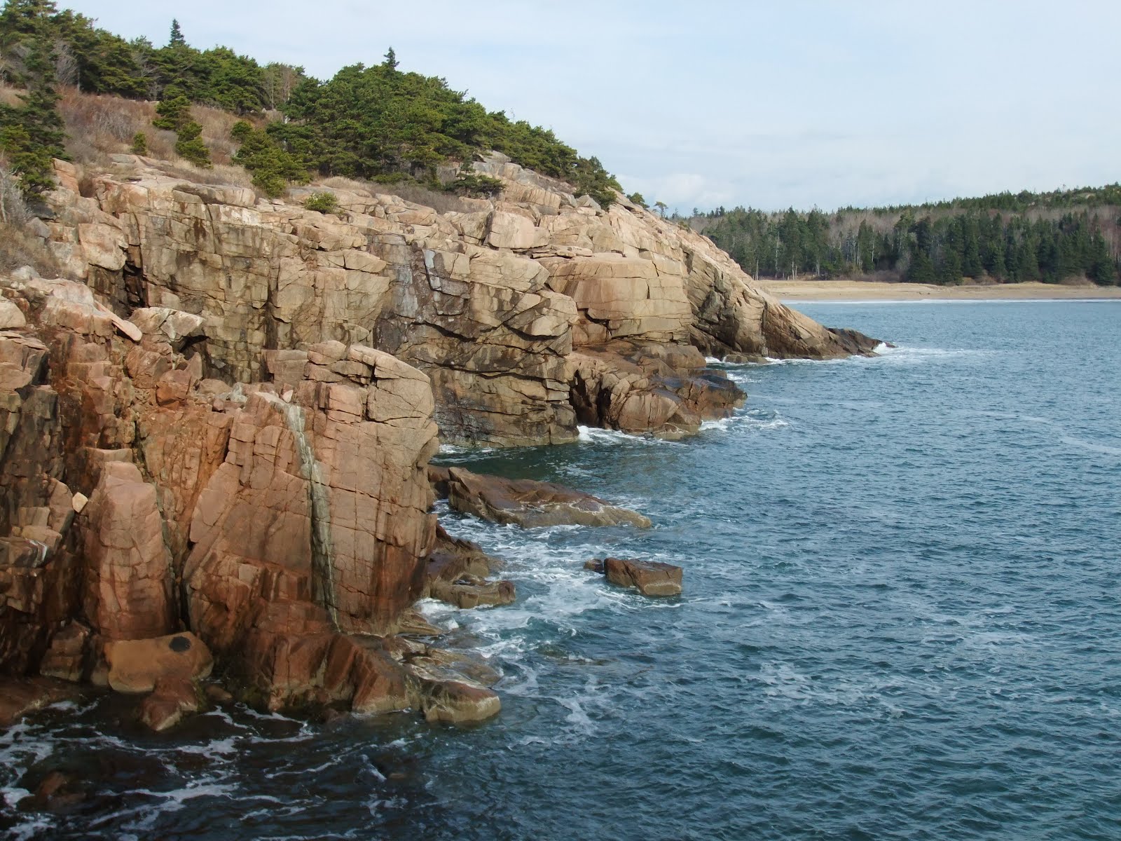
I’ve been to the ocean in places with beaches – Florida, Southern California, Jamaica, but never witnessed big waves crashing against rock and cliffs like I’ve seen in TV shows and movies about the Pacific Northwest (The Goonies). Acadia provided me with the views I’ve been looking for. The waves may not have been big, but you could still feel the power they hold as they battered the rocks just a few feet in front of me. One slip, overzealous step, or large wave could’ve meant curtains for me. Even with my awareness of the danger the cold waters presented, I danced from rock to rock, trying to find the best view and perfect camera shot (I always thought I possessed great talent to hop around on rocks and boulders). The ocean was not my demise, at least not yet.

I look so happy

I traveled down the coast and found Sand Beach, a rare sight along the Maine coastline. Walking along the beach, I got a little too close and a wave swept up over my shoes. I only wanted to feel the water with my hand, not soak it up with my shoes and socks. Whoops.


I moved onto Thunder Hole where the waves are funneled into a cleft in the cliffs, producing huge spray and the thunder sound. The thunder was quiet for my visit, but I got an idea of what she was like in top form as a few waves launched water into the air. I got talking to a guy named Everett who lived in the area. He liked to walk down to the Thunder Hole and see how it’s acting up on a regular basis. Apparently it can be quite impressive (skip to the last 30 seconds). We talked about the park as he informed me of the history and some neat facts. He pointed to the cliffs just south of us and said they were the highest cliffs along the Atlantic Ocean until you get to Rio de Janeiro. Those are the tidbits I like. I asked him where I could find the Internet in Bar Harbor so I could do a little planning for the rest of my trip. He wasn’t sure, so Everett invited me over to his house. I’m not one to turn down a strangers offer to help, so I gave him a ride back to his place. I found the info I was looking for and we proceeded to talk away the afternoon.

Thunder Hole (The calm before the storm?)

Everett told me a story about how when Martha Stewart bought a house on the island, she wanted to use the phone at the general store but the clerk said the phone was just for employees. Martha said she really needed to use the phone, but the worker would not relent and then Martha busted out the “Do you know who I am?” Martha got a tap on the shoulder and an elderly gentleman said “Ms. Stewart, they don’t let me use the phone either.” It was David Rockefeller.

Everett said I could stay at his house or take a shower if needed, but I passed because I already had a great campsite and had to get up early the next morning if I wanted to catch the sunrise from atop Cadillac Mountain. Before I left, I showed him a few of my pictures because he was a photographer and he was not impressed. I have a lot of work to do if I want to get better at photography.

I drove around the island checking out the small towns bathed in the falling light of the setting sun. It was quite beautiful. With night getting comfortable, I headed back to Geddy’s for a few drinks. More conversation was had as I finished sampling the local beers. A few hours later, I called it a night. I set my alarm for 4:15 so I’d have enough time to hike the 3.5 miles to the top of Cadillac Mt. and be the first person in the US to see the sunrise. It was a crystal clear night as I sleep soundly in anticipation of my trek.